Penfield, South Australia
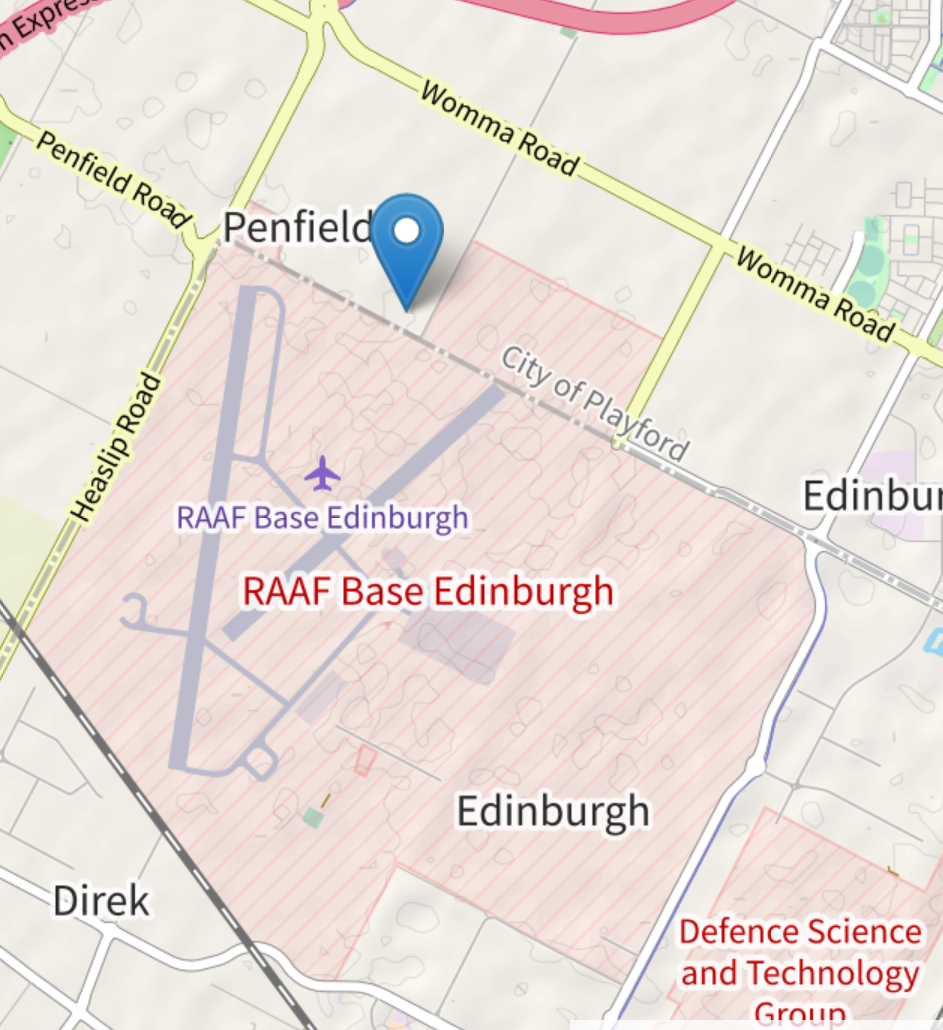
Penfield /ˈpɛnfiːld/ is a northern suburb of Adelaide, South Australia, situated within the City of Playford. As part of this growing urban region, Penfield features a blend of residential, agricultural, and industrial areas, contributing to its diverse landscape. The suburb is strategically positioned in the northern section of Adelaide, enjoying close proximity to key transport routes and nearby commercial centers. Being under the jurisdiction of the City of Playford, Penfield is included in a local government area recognized for its ongoing expansion and development. This makes Penfield a significant location for both residential living and economic activities within the northern metropolitan region of Adelaide.
| Penfield Adelaide, South Australia | ||||||||||
 | ||||||||||
| Penfields town location. | ||||||||||
| Founded | 1850 | |||||||||
| lga | City of Playford | |||||||||
| postcode | 5121 | |||||||||
| stategov | Taylor | |||||||||
| fedgov | Spence | |||||||||
Suburbs around Penfield:
| ||||||||||
History
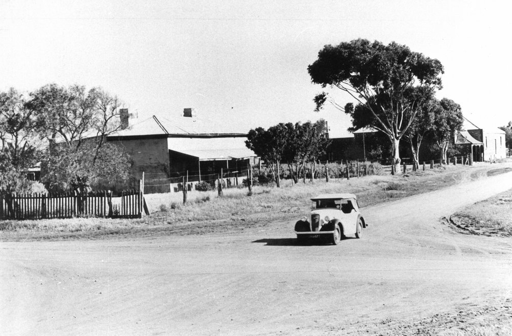
In December 1850, William Friend Penfold (1806-1884) acquired Section 4057 of Hundred of Munno Parra. In 1851, the Penfield Post Office opened, located 7km north of Salisbury. In 1853, Penfold established the Plough and Harrow Hotel. Finally, on February 1st, 1856, Penfold subdivided his section into a town named Penfield. Initially, the area was commonly known as the Peachy Belt until 1858.[1]Penfield, a postal township within the electoral district of Yatala and the hundred of Munno Para,

fell under the governance of the district council of Munno Para W. Located approximately midway on the Gawler Plains, it lay about 11.2 kilometers south of the Gawler River and 8 kilometers north of the Para River, serving primarily as an agricultural center. Farmers cultivated various grains and engaged in sheep grazing in the vicinity. Closest to Penfield were Salisbury, situated about 9.6 kilometers southeast, and Virginia, approximately 6.4 kilometers away. Communication was facilitated by Rounsevell's daily mail coach, connecting Penfield to Adelaide, roughly 29.7 kilometers to the south, via the coach to Salisbury and subsequent train transportation. Penfield boasted essential amenities, including a post office, a substantial wheat store, shops for tradesmen, a literary institute with a library, and the Plough and Harrow Inn as the sole hotel. The surrounding terrain comprised extensive plains bordered by the sea to the south and west, while hills stretched from Adelaide to Gawler in the east and northeast. Much of the previously wooded areas had been cleared for agricultural purposes.[2]
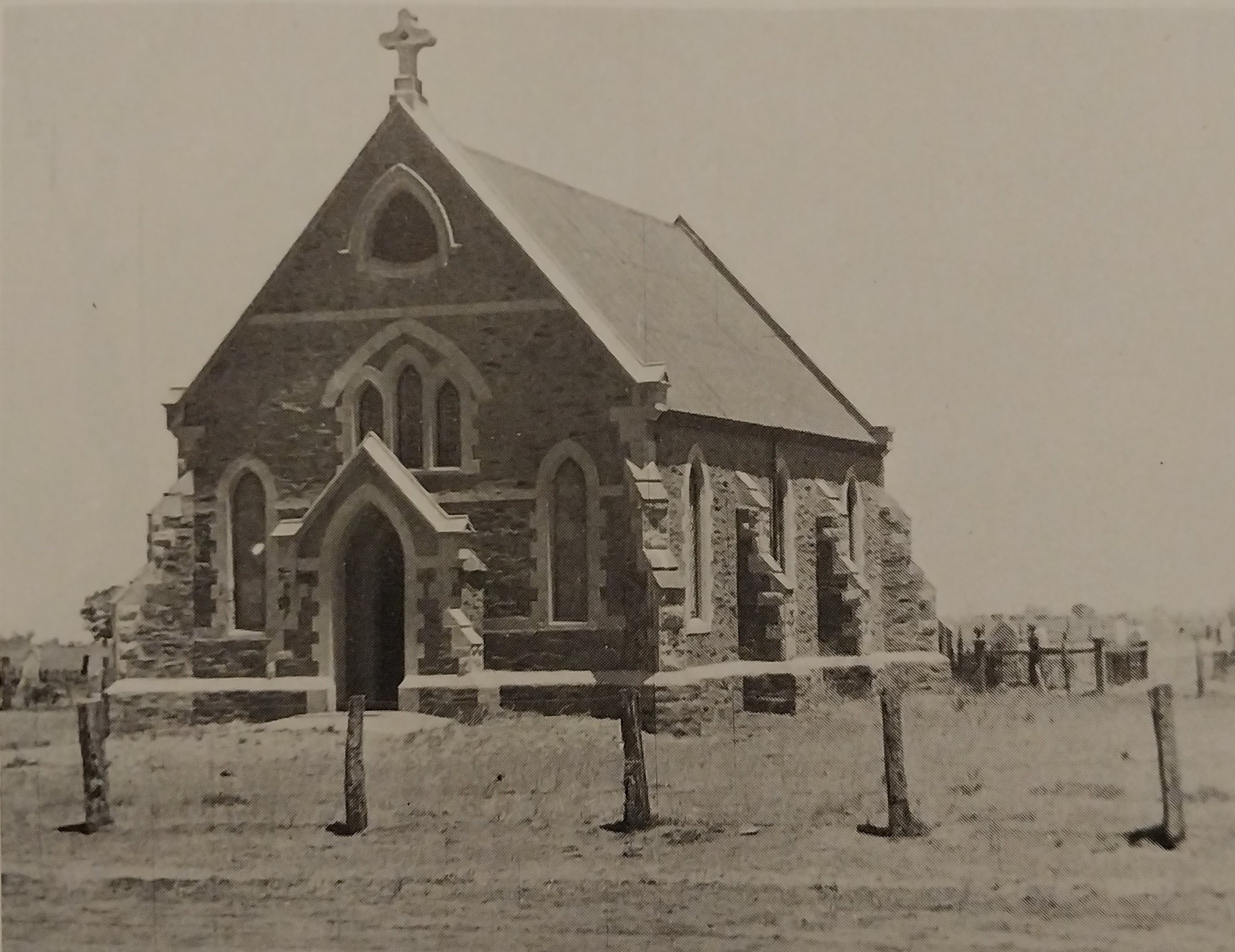
Zoar Bible Christian Chapel
Near the township of Penfield lies the remnants of a small cemetery, all that remains to mark the site of the original Zoar Bible Christian Chapel opened in 1855.

The church was demolished in 1956 and many of the headstones in the cemetery have since been vandalized. The Zoar cemetery contains the graves of noteworthy figures from the region's early settlement, such as Eleanor Penfield, Thomas Long, and Catherine Way, find their final resting places within the Zoar cemetery grounds.[3] Penfield School opened as a Government School in 1874, with Mary E. Wilkinson as the teacher. The school was designed to accommodate 36 children, but the average attendance for the first year was 11. The school operated for 108 days a year, and the average attendance for each child was 60 days, which is 10 days less than the statutory requirement. Penfield School closed on 31 December 1940, with Thomas V. Partridge as the Head Teacher at the time.[4]
World War II
In September 1940, with the onset of World War II, the Commonwealth Government compulsorily acquired a large percentage of land at Penfield to build an explosives and filling factory known as the Salisbury explosives factory. The Government paid a low price for the land, between £10 and £14 per acre at the time, causing conflict between the government and landowners. However, the importance of the war overruled the landowners' objections, and the farming families were evicted from their land, leading to the destruction of the township of Penfield. After the war, the munitions factory at Salisbury was repurposed as laboratories for the Woomera Range. Initially known as the Long Range Weapons Establishment and later the Weapons Research Establishment (WRE), it eventually became the Defence Science and Technology Organisation (DSTO). The Edinburgh Airfield was opened in 1954, following the decision that the Mallala airport was no longer practical.[5]
Peter peachy
In the Hundred of Munno Para, the area was surveyed in 1849, and the resulting plan was titled Survey of Sections in the Peachey Belt The diagram illustrates that the region was nearly entirely forested, likely with the native peach quandong trees[6]. Prior to the survey Peter Peachey, a surveyor, demonstrated his keen interest in South Australia as far back as 1833, a passage in Robert Gouger's journal dated December of that year records, Peter Peachey called and expressed intentions of becoming one of the first settlers. This aligns with the period when plans for the colonization of South Australia were being drafted in London. Following this, Peachey assumed the role of overseer on Parnaroo station during his uncle George Williams' tenure of ownership. His endeavors are further documented in John Lewis' publication 'Fought and Won.'[7]
References
- Manning's place names of South Australia, G.H.Manning, 1990, P.243.
- Bailliere's South Australian Gazetteer and road guide, 1866, P.181.
- City of Playford, A Brief History, By Linda Allery & Grace Trimboli, 1999, P.31.
- Salisbury, South Australia: A History of Town and District, By H. John Lewis, 1980, P.88.
- City of Playford, A Brief History, By Linda Allery & Grace Trimboli, 1999, P.31
- Mannings Place Names of South Australia, By Geoffrey.H.Manning, 1990, P.242.
- South Australia what's in a name, By Rodney cockburn, 1908, P.171.

