
Semaphore, South Australia

This area, established after Glenelg, became the preferred landing and signal station spot due to its strategic advantages.
| Semaphore Adelaide, South Australia | ||||||
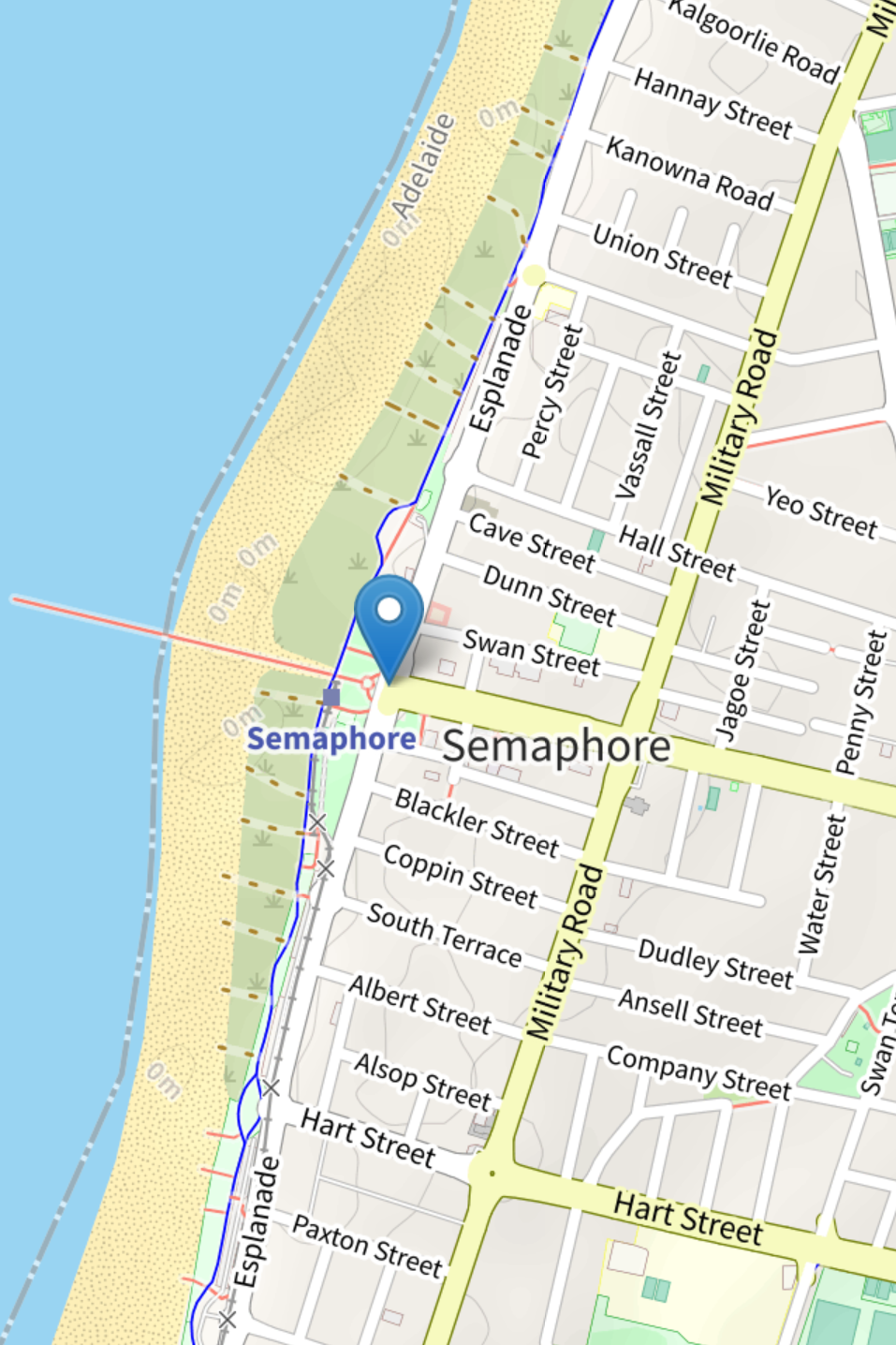 | ||||||
| Map of Semaphore | ||||||
| suburb | Semaphore | |||||
| lga | City of Port Adelaide Enfield | |||||
| postcode | 5019 | |||||
| est | 1849 | |||||
| sate | South Australia | |||||
Suburbs around Semaphore:
| ||||||
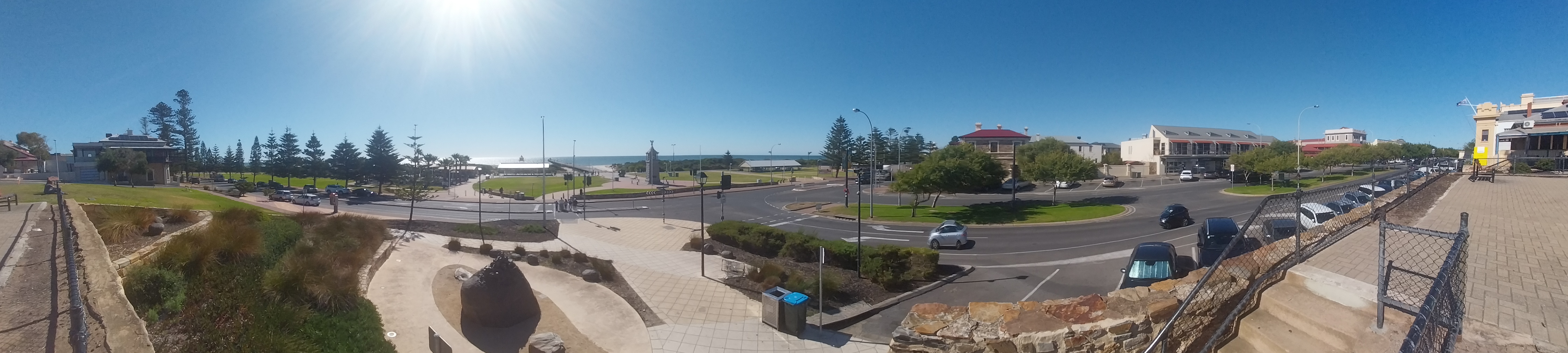
Now, it's a bustling suburb about 9 miles (14 km) northwest of Adelaide,[1] situated on the Lefevere Peninsula[2] the area is known for its vibrant community and thriving local economy.[3]
History
Semaphore owes its name to the fact that is was the site chosen for a signalling station and landing place for ships, In preference to Glenelg[4] According to H.C. Talbot,
Semaphore was designated as the location for a signaling station and landing site approximately one year after the colony's establishment. In October 1849, the neighboring land was surveyed, and a few acres were earmarked for mail reserves. Despite Semaphore being extensively utilized as a harbor as early as 1837, land in the surrounding area was not sold until 1850[5] Semaphore flags were utilized as a method of signaling. The initial documented subdivision identified as Semaphore occurred in 1864. The land was acquired from the original grantee, George Coppin, by William Blackler, who was a licensed victualler a term historically used to refer to someone who is licensed to sell alcoholic beverages. These names persist in Semaphore as street names. However, Blackler Street was initially referred to as Semaphore Road.[6] The telegraphs located at the coast and on West Terrace were actively reporting all vessels moving through the port, particularly those displaying Marryat's signals, a naval flag code used for maritime communication. Semaphore was an independent municipality before merging with the Port Adelaide Corporation, with a significant portion of its residential area sold in April 1864.[7]
Transportation
South Australia's first public railway opened on April 19, 1856, connecting Adelaide and Port Adelaide (Port Dock). An extension to the line was planned, but it wasn't until after the new Jervois Bridge was constructed that the railway reached its terminus at Semaphore. The railway construction was completed in September 1877, but the opening was delayed until the new Jervois Bridge was finished and tested, which occurred at the end of December that year.[8]
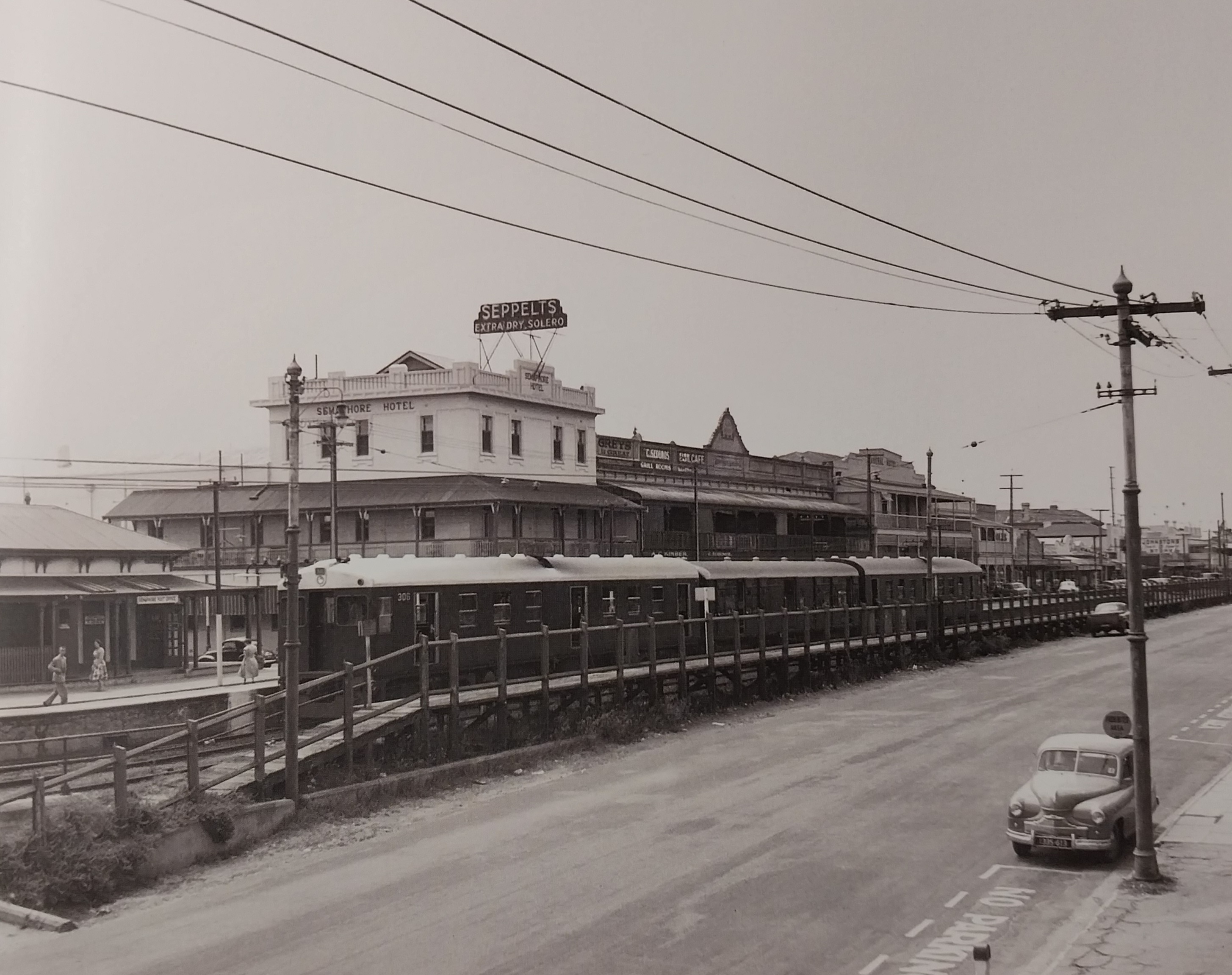
The Semaphore station opened with a 152-meter platform. Between 1883 and 1884, a narrow-gauge tramway was added for mail transfer. The station building was constructed in 1881 and relocated closer to the beach in 1885. Although an extension to Largs Bay was proposed in 1891, it was never realized. In 1897, the platform was rebuilt, refreshment rooms were opened, electric lights were installed, pathways were paved, and a protective fence was erected. The SAR took over the operation of the refreshment rooms in 1926 until their closure in the late 1930s. By 1927, the station staff included a Class 5 Station Master and a Class 6 Assistant. A new station building and offices were constructed in 1939-1940, and the red brick station officially opened in 1941. Additionally, in 1940, the northern side of Semaphore Road was made a one-way street.[9] The last train to depart Semaphore was on the 29th October 1978 at 7.02pm.[10]
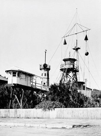
Semaphore Lighthouse
The Semaphore Lighthouse was a significant navigational aid located off Semaphore, South Australia. Managed by the Engineer-in-Chief's Department, it played a vital role in maritime navigation during its operational years. The lighthouse was part of a broader network of lighthouses and signaling stations along the South Australian coastline. It underwent regular maintenance, including:
• Replacement of lamps and fittings to improve its functionality.
• Installation of communication systems, such as telephones, between the lighthouse and keepers' quarters.
Over time, advancements in maritime navigation technology and changes in port operations rendered the Semaphore Lighthouse obsolete. It no longer exists today, but its historical role in supporting South Australian maritime operations remains notable. While the Semaphore Lighthouse is no longer standing, its history is tied to the development of coastal infrastructure, including:
• Dredging operations and jetty expansions.
• Installation of additional navigational aids to support increasing maritime traffic.[11]
References
- Place Names of South Australia, By R.Praite & J.C.Tolley, P.168
- The Cyclopedia of South Australia, Vol.1, By The Cyclopedia Company Adelaide, P.388.
- Place Names of South Australia, By R.Praite & J.C.Tolley, P.168
- South Australia what's in a name, BY Rodney Cockburn, 1908, P.
- The Romance of Place Names of South Australia, By Geoffry.H.Manning, 1986, P.189.
- The Romance of Place Names of South Australia, By Geoffry.H.Manning, 1986, P.189.
- South Australia what's in a name, BY Rodney Cockburn, 1908, P.
- Stations Remembered, SAR Semaphore & Exeter, By Steve McNicol, 2020, P3.
- Stations Remembered, SAR Semaphore & Exeter, By Steve McNicol, 2020, P6.
- Stations Remembered, SAR Semaphore & Exeter, By Steve McNicol, 2020, P12, P.13.
- The Cyclopedia of South Australia, Vol.1, By The Cyclopedia Company Adelaide, P.385-386.